

Looking for a list of the best hiking trails in Canmore that don’t require a full-day investment and are kinder on the knees? Well, you’re in luck – some of the best hikes in Canmore take only an hour or so to complete and are perfect for the entire family.
We’ve been lucky enough to live in Canmore on a couple of different occasions. After spending so much time here and hiking as much as we could, we’ve compiled this detailed list of the best easy hikes in Canmore and the surrounding area.
Knowing that sometimes people don’t want to drive far to reach a trailhead, I’ve divided this blog into two sections: easy hikes right in Canmore or less than a 5-minute drive away, and then easy hikes that are nearby in either the Kananaskis or Banff National Park. Let’s get to it!
- Our Favorite Easy Hike in Canmore
- Easy Hikes in Canmore, Alberta
- 1. Grotto Canyon
- 2. Quarry Lake Loop
- 3. Rundle Forest Reservoir Walkway
- 4. Policeman’s Creek Boardwalk
- 5. Three Sisters Viewpoint
- 6. Heart Creek Trail
- 7. Benchlands Ridge Trail and Hoodoos
- 8. Grassi Lakes
- 9. Bow River Loop Trail
- 10. Horseshoe Loop
- 11. Rocky Mountain Legacy Trail
- 12. Montane Traverse
- 13. Ha Ling Peak
- 14. Miner's Peak
- Easy Day Hikes near Canmore, Alberta
- Other Things to do While You're in Canmore
- Where to Stay in Canmore
- Thanks for reading!
- Renting a Car in Alberta
- AIRALO e-SIM Up To 15% Off With Code "DTRAVEL15"
- What’s an eSIM?
Our Favorite Easy Hike in Canmore

Dan and I are keen hikers, so you can bet we’ve seen all kinds of trails – the good and the bad! But with that said, the Grassi Lakes hike stole our hearts when we first tried it out. Not only was the hike to the lakes easy and fun but we were also rewarded with some truly stunning views at the end!
If you’re looking to try just the one trail here in Canmore, Grassi Lakes won’t let you down. At just 4 kilometers long (2.5 miles) return, the trailhead and car park are just over a 10-minute drive from downtown, making it super easy to reach too.
It’s perfect for families, couples, dogs, everyone really! We loved this trail so much that we dedicated an entire blog post to it, so why not check out our complete guide to Grassi Lakes, once you’re finished up here?
Easy Hikes in Canmore, Alberta
The following 25 hikes are my personal favorite easy hikes in Canmore that can all be done in under a day (most in only an hour or two!) They are all located in Canmore township or within a 5-10 minute drive.
Note: A Kananaskis Conservation Pass is now required to explore the Kananaskis region. These passes can be bought at the Kananaskis Visitor Center or online in advance and cost $15 CAD per vehicle per day or $95 CAD per year (for two vehicles).
1. Grotto Canyon

- Distance: 4.2 kilometers (2.6 miles) return
- Elevation gain: Approximately 220 meters (722 feet)
- Difficulty: Easy
- Time needed: 1.5-2.5 hours
- Type of trail: Out and back
Grotto Canyon is easily one of the most unique hikes in the Canmore area! At 4.2 kilometers long (2.6 miles), the Grotto Canyon hike is only moderately difficult and easy enough for most fitness levels. In fact, most people only take a couple of hours to complete it.
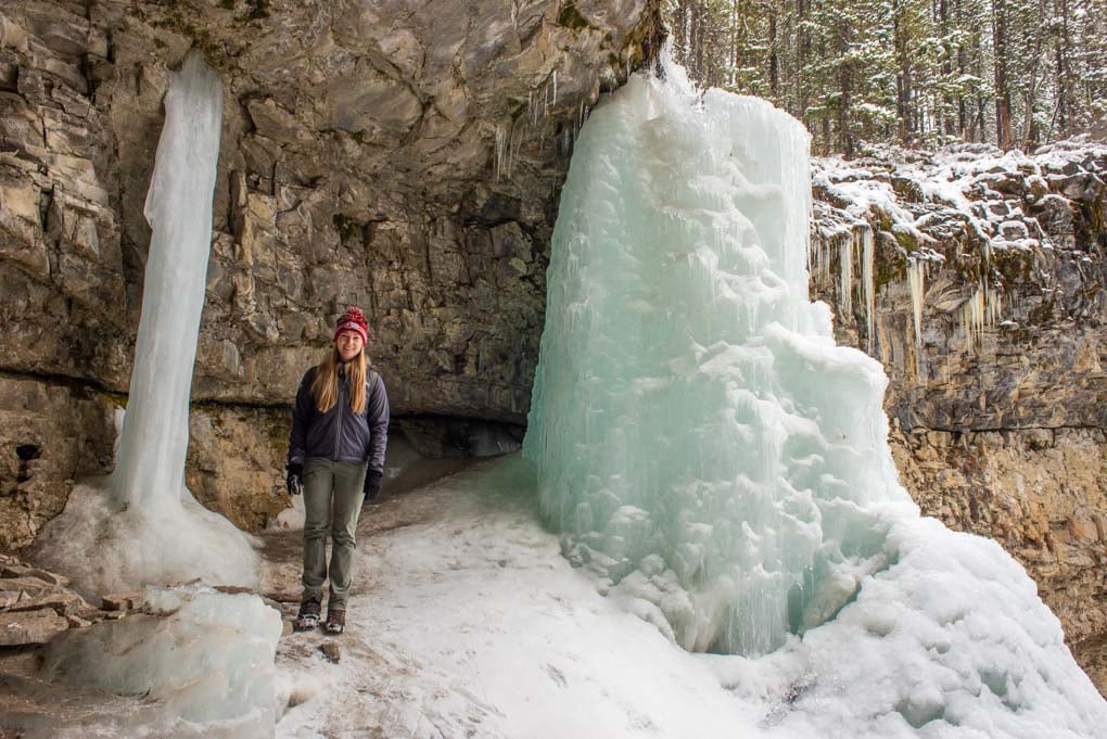
Grotto Canyon can only be accessed on foot. While it’s gorgeous at any time of the year, it is especially popular in winter, when most of the canyon’s floor is covered by ice and visitors have to use crampons.
To access the Grotto Canyon Icewalk trail, you can start at the Grotto Mountain parking lot and walk for 1 kilometer (0.62 mi) before you arrive at the creek that is going to twist and stretch for approximately 1 more kilometer.
The trail to Grotto Canyon is pretty easy to follow, and there are numerous signs along the trail to keep you on the right track.
After you pass the creek, the canyon walls are going to get narrow and, if you hike in winter, you will see a sheet of ice under your feet. After walking through the canyon, you will get to the junction from which you can access a pretty cool waterfall (since it freezes in winter, it attracts a lot of ice climbers) if you make a right turn.
You can read our complete blog on Grotto Canyon here before you go!

To your left, you will also spot the falls, and if you look closely, some ancient pictographs. Many hikers miss this spot, so if you have never been to Grotto Canyon and are not sure where to find them, ask someone on a trail, or before you start your trip.
If you’re visiting Banff in the winter, you can also opt to go on this Ice Grotto Canyon Icewalk tour versus attempting it on your own. This tour includes all the equipment you need, and you’ll also be joined by a guide who is super knowledgeable about the canyon’s history and geology.
Even for seasoned trail walkers like us, we found it really refreshing getting to go alongside a local and learn things that we would never have been able to do otherwise! A light snack and steaming hot chocolate were also waiting for us at the end! This tour lasts 4 hours and costs $99 CAD.
If you’re visiting from Canmore, you can still hike Grotto Canyon in the snow without a tour, just be prepared with warm gear and crampons or snowshoes.
To me, Grotto Canyon is most impressive during the winter months when the canyon is frozen. I honestly wouldn’t bother with this trail during the summer and would instead recommend another easy Canmore trail such as Stewart Canyon or Johnston Canyon (more info on both further down on this blog).
Book this epic icewalk tour through Grotto Canyon in advance with FREE cancellation options!
Related Read: Hiking Grotto Canyon is one of the best things to do in Canmore in the month of December – read our blog for more info on seasonal and festival events during this popular time to visit Canmore!
2. Quarry Lake Loop

- Distance: 1.1 kilometers (0.7 miles)
- Elevation gain: None
- Difficulty: Easy
- Time needed: Less than an hour
- Type of Trail: Loop
The Quarry Lake Loop is a super popular hike in Canmore among locals. Located just minutes from town and with an off-leash dog park, picnic area, and places to swim, it’s no wonder people love this gorgeous spot.
Quarry Lake Loop trail itself is more of a walk rather than a hike, and the most challenging part about visiting Quarry Lake is finding parking. At only just over 1 kilometer (0.62 mi) long and with no elevation gain, this easy trail takes you from the car parking lot around Quarry Lake and back again.
Parking here is paid, and costs $10 CAD per vehicle for 2 hours during peak season (May 15 – Oct 14), outside of this timeframe, it costs just $2.50 CAD per vehicle for two hours.
Most people visit Quarry Lake to spend an afternoon as opposed to just walking the trail which is really quick. Bring a picnic and a towel and enjoy the area! The lake also offers stunning mountain reflections on calm days, making for excellent photo opportunities.

As I mentioned, the hardest part about hiking Quarry Lake Loop is finding parking. During hot summer days, the parking lot frequently fills up leaving. My best advice is to visit first thing in the afternoon or later in the day for sunset. This is when you are most likely able to snag a parking spot!
Quarry Lake Loop is also a hike you can do all year round. Just be warned that in the winter months, the lake looks frozen, but it isn’t! Never attempt to walk on Quarry Lake, since it never fully freezes. Ice cleats will come in handy during the winter months too when there is ice on the trail.
3. Rundle Forest Reservoir Walkway

- Distance: 4.6 kilometers (2.9 miles) return
- Elevation gain: None
- Difficulty: Easy
- Time needed: 1-2 hours
- Type of Trail: Out and back
Just across the road from the Canmore Nordic Center is Rundle Forest Reservoir. This is a common spot to go kayaking or standup paddleboarding. In the summer months, it’s not uncommon to see groups of people lounging at the water’s edge. But, what many people don’t know is that there is actually a beautiful walking trail here.
From the parking lot, head towards the reservoir and turn left. You’ll see a walking trail that follows the water’s edge. The walking trail goes for just over 2 kilometers (1.24 miles) and ends at Smith Dorrien Spray Trail Road.
One of the things I like most about this trail is that it is never busy. Since it is such a flat trail, I often visit at sunset with a cup of tea in my to-go cup. I can enjoy the calm water, mountain views, and an easy walking trail without another soul in sight!
4. Policeman’s Creek Boardwalk

- Distance: 3.9 kilometers (2.4 miles) one-way
- Elevation gain: None
- Difficulty: Easy
- Time needed: 1-3 hours, depending on how far you go
- Type of Trail: Out and back
When it comes to easy hikes in Canmore, Policeman’s Creek takes the cake! First of all, this hike literally runs through the middle of Canmore town, so you can likely jump onto it right from your hotel.
Second, it is a boardwalk which means no elevation gain, rocks, or mud – just a nice man-made boardwalk. It honestly can’t get easier than this!
Policeman’s Creek Boardwalk runs along the edge of Policeman’s Creek, smack-dab through the middle of Canmore. The entire boardwalk stretches 3.9 kilometers (2.4 miles) from one end to the other, but most people don’t walk the entire thing.
You can simply access the boardwalk from many intersections and streets in Canmore and go for a wander. To me, it’s a good place to go for a leisurely stroll – we even include it on the first morning of our detailed 3-day Canmore itinerary. Walk as far as you feel and then turn back around. Expect to see mountain views, lots of ducks, and maybe even kayakers on the creek.
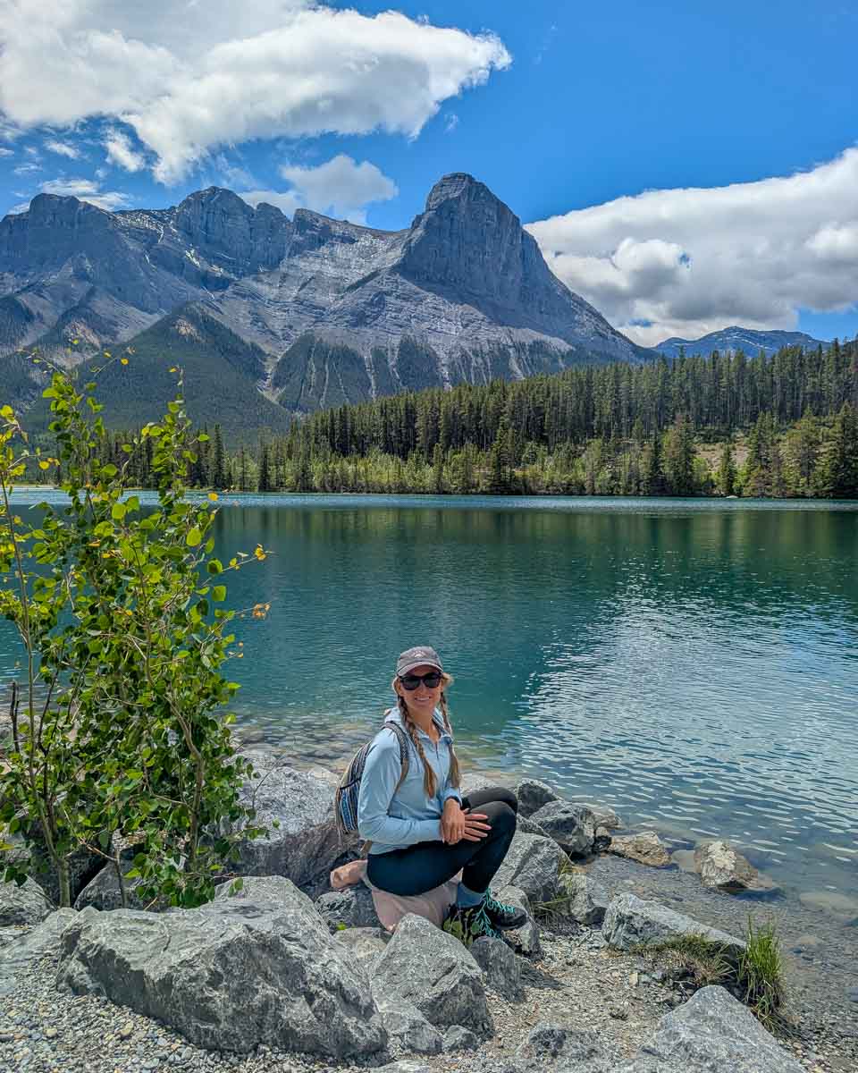
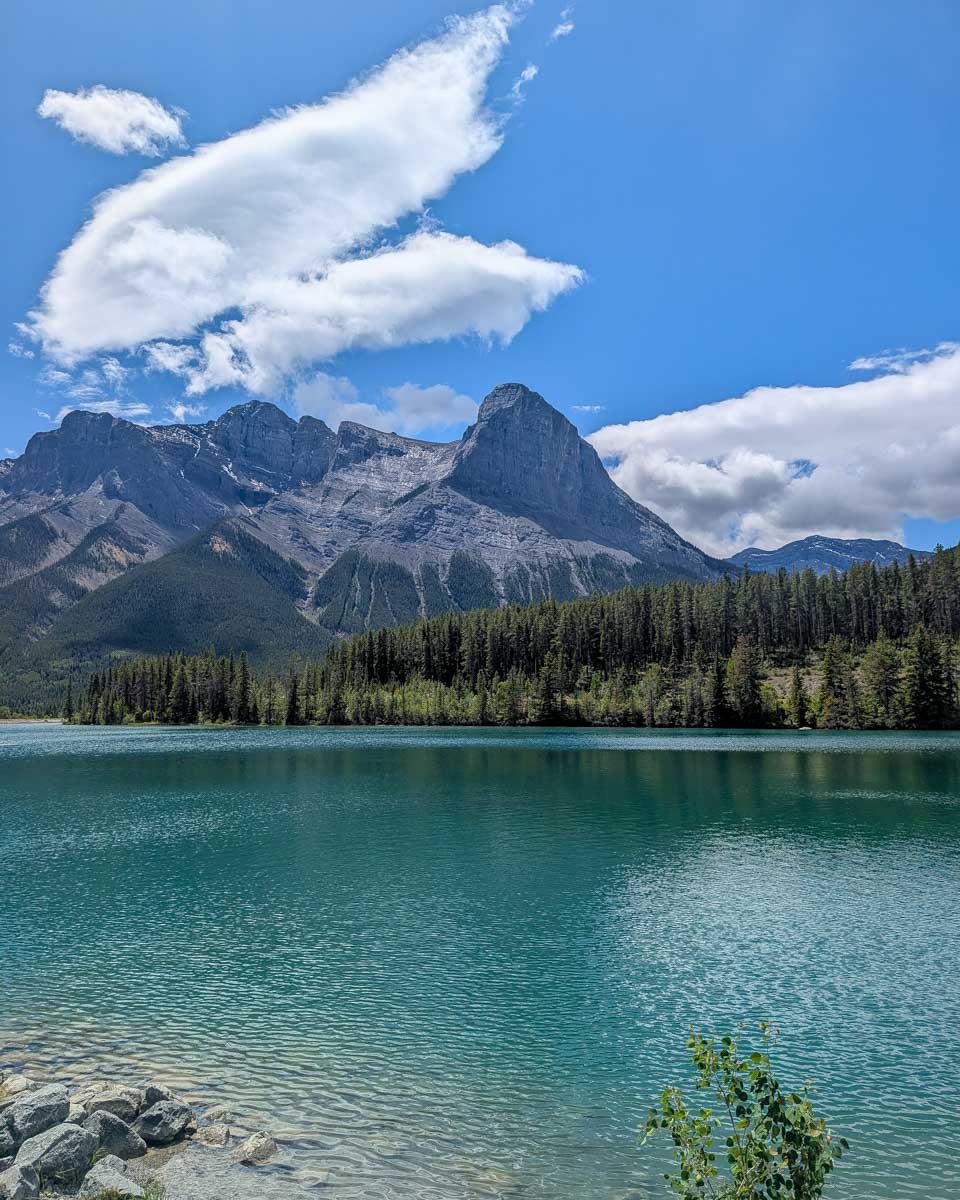
5. Three Sisters Viewpoint

- Distance: Less than 1 kilometer (0.6 miles)
- Elevation gain: None
- Difficulty: Easy
- Time needed: 30 minutes
- Type of Trail: Out and back
This hike isn’t an official trail in Canmore, but I think it should be! This trail has become popular among photographers who visit the area to take pictures of the Three Sisters mountain range.
Dan and I spent an evening here, photographing the amazing reflection in the creek and then the Milky Way as it got dark. The only other people around were, you guessed it, photographers! We love this spot so much that we actually include it in our list of the most Instagrammable places in and around Banff.
But I don’t think you need to be a photographer to enjoy this easy trail and incredible viewpoint.
Since this isn’t an official trail, you won’t find signs or maps. However, it is really easy to find yourself if you follow my directions. We parked at the off-leash dog park just on the edge of Canmore, and from here, we crossed the road and went under the train bridge. Following the creek (keeping it to our right) we followed a well-trafficked trail into the forest.
After hiking for about 5 minutes, we found our way to the creek.
You’ll know you’re in the right place when you have an incredible view of the Three Sisters in front of the creek. It’s a beautiful spot and one of the few hikes in Canmore that not many people know about.
6. Heart Creek Trail

- Distance: 2.6 kilometers (1.6 miles) return
- Elevation gain: Approximately 100 meters (328 feet)
- Difficulty: Easy
- Time needed: 1-2 hours
- Type of Trail: Out and back
Heart Creek Trail is a fairly easy hiking trail located about 10 minutes outside of Canmore at the Lac de Arcs exit from Highway 1. This trail takes you through the forest, along the edge of Heart Creek, and through Heart Canyon.
Heart Creek Trail is very popular with rock climbers as there are a couple of walls perfect for the sport. However, if you are just looking for a nice and quiet trail, this is a good option too.
To find the trailhead, you can exit Canmore on Highway 1 towards Exshaw. Take the Lac de Arcs exit and immediately go right toward the marked parking lot. From here, simply follow the trail and once you get to the fork in the trail, go right.
If you want more of a challenge, then you can go left. This takes you to an entirely different trail called Heart Mountain Horseshoe Loop. I personally love this hike, but it is a difficult one that I wouldn’t recommend for beginners. If you want more information on it, you can read our blog about hiking Heart Mountain.
7. Benchlands Ridge Trail and Hoodoos

- Distance: 4 kilometers (2.5 miles) return
- Elevation gain: Approximately 200 meters (656 feet)
- Difficulty: Easy
- Time needed: 1-2 hours
- Type of Trail: Loop trail
Benchlands Ridge Trail is an easy hike right in Canmore with a gradual incline up to a viewpoint overlooking the valley. It technically starts from downtown Canmore and takes you over a bridge to cross the highway. Follow the path along Benchlands Trail and when there is a sharp left, take it. You’ll start to climb up a path until you are on a ridge overlooking Canmore – it’s beautiful!
If you want to skip walking across the highway, you can park at either Cougar Creek or the Benchlands Trail Bike Park.

The trail is 4 kilometers long (2.5 miles) in total. At the top of the ridge, there are a couple of hoodoos that are pretty neat to check out too! From the hoodoos, we headed downhill until we passed a cemetery and got back onto the trail. Otherwise, you could also just walk back the same way you came.
Although it isn’t my favorite trail in Canmore, it is a good option for those looking to stay close to town and wanting to see hoodoos too!
Hot Tip: Want an even shorter hike? Drive up to Benchlands Terrace and park at the end of the residential street there. From here you’ll see the trail and hoodoos. The view is awesome and really no hiking is required!
8. Grassi Lakes

- Distance: 4-kilometer (2.5-mile) loop or return
- Elevation gain: 125 meters (410 ft)
- Difficulty: Easy
- Time needed: 2 to 3 hours
Grassi Lakes is without a doubt the most popular hike in Canmore! After hiking the trail twice for myself, it’s not hard to see why. This short trail is easy to accomplish and ends at the stunning Grassi Lakes.
Grassi Lakes is also one of the easiest hikes in Canmore at only 4 kilometers long (2.5 miles) return trail with only a 125-meter (410 ft) elevation gain. This means it’s family-friendly and suitable for most fitness levels. When we last hiked the Grassi Lakes trail, there were tons of families on the trail with young kids and dogs.
The trail starts from the large car parking lot just on the outskirts of Canmore. Parking is free and it’s important to arrive early to secure a parking spot!

One thing to note is that there are two different trails you can take to reach Grassi Lakes. From the Grassi Lakes parking lot, there is one trail. After walking this trail for a couple of minutes, we came to a fork in the trail with a sign. Staying on the left-hand side, we took the more difficult trail, while sticking to the right-hand side will take you along the easier alternative.
The more difficult trail is flat at the beginning but then takes a steep incline with stairs taking you next to a waterfall. While it is a more challenging trail, it’s worth it for the waterfall!
During the winter months, the more difficult trail closes due to ice build-up. But you can still hike to Grassi Lakes via the other trail.
For more detailed info, check out our blog all about hiking the Grassi Lakes trail.
9. Bow River Loop Trail

- Distance: 2 kilometers (1.24 miles) return
- Elevation gain: Approximately 50 meters (164 ft)
- Difficulty: Easy
- Time needed: 30 minutes to an hour
- Type of Trail: Loop
The Bow River Loop Trail is definitely one of the easiest hikes in Canmore. Not only does it start right in downtown Canmore, but it is pretty much completely flat and offers stunning views in every direction.
One of the highlights of the Bow Valley Trail is crossing the steel bridges over the Bow River. From here, the views of the Three Sisters is picture-perfect.

This short 2-kilometer long (1.24 miles) loop track only gains about 50 meters (164 ft) in elevation, so it’s actually super easy and family-friendly. In the winter, some parts of the trail can be a little icy, but if you’re careful, you should be just fine!
There are plenty of benches lined along the river’s edge on the trail. They make for the perfect place to stop for a packed lunch or just relax and enjoy the view. When we lived in Canmore I would often come here to just read my book for a couple of hours in the sunshine.
While we love discovering epic spots like these for ourselves, there’s also something especially memorable and fun about joining a local guide! This Cowboys and Coal Miners history tour explores Canmore’s amazing history, with stops at the famous iron bridge, local wildlife hotspots, and so much more!
We love that this is a private tour, too, so you’ll have 100% of the guide’s attention from start to finish. This means plenty of opportunities to ask all of your questions!
Starting from $74 CAD per person for this 1.5-hour tour, we think this is fantastic value and a no-brainer if you’d love to walk a beautiful trail that’s been mapped out for you.
This tour has limited dates available, be sure to secure your spot here so you don’t miss out!
10. Horseshoe Loop

- Distance: 5 kilometers (3.1 miles) return
- Elevation gain: Approximately 150 meters (492 feet)
- Difficulty: Easy
- Time needed: 2-3 hours
- Type of Trail: Loop
This is a great trail for those looking to get away from the crowds, especially during the busy summer months. Starting at the Cougar Creek Parking lot, we walked along the creek until we saw a sign for Horseshoe Loop, and from here we went right and up into the forest!
The Horseshoe Loop Trail is a multi-use trail, meaning you’ll often see bikers and sometimes even horses here. The popularity of the area has created lots of smaller trails, which some may find confusing. With that said, we stuck to the larger, more clear path and did just fine.
We also came across some signs along the way, which helped keep us on the right path!

Other than a bit of an incline at the beginning, this trail is mainly flat. It’s also through the forest, and as such, there aren’t as many opportunities for viewpoints.
If you don’t want to walk the entire 5-kilometer loop (3.1 miles), there are opportunities to cut it short by walking down toward the houses and taking the residential streets back to the creek. These will be smaller trails off the main trail, but it is easy enough to navigate.
11. Rocky Mountain Legacy Trail

- Distance: 20 kilometers (12.4 miles) one-way (but don’t walk the whole thing!)
- Elevation gain: 185 meters (607 ft) (super gradual and feels flat)
- Difficulty: Easy
- Time needed: As much as you want!
- Type of Trail: Point to point
The Legacy Trail is best known by cyclists who ride this flat paved trail between Canmore and Banff. At just over 20 kilometers long (12.4 miles), this trail actually connects Canmore and Banff, and thus, is a popular route for cyclists!
That’s not to say you can’t enjoy parts of this trail on foot, though. The wide track is paved and makes for an easy hike that starts right in the heart of Canmore. It’s perfect for those with a stroller.
The Legacy Trail in Canmore starts near the highway just past the Canmore Gold Club. It’s well signed, and you honestly can’t miss this 3-meter (10 ft) wide path. You can hike for as long as you feel, before turning around and heading back to Canmore the same way.
A couple of things to note about the Legacy Trail is that it can be pretty busy on the weekends in the summer months. As somebody walking, you should be aware of lots of cyclists. For a quieter experience, we recommend going mid-week.
There is also limited shade on the trail. Be sure to wear a hat and sunscreen – especially if you’re hiking with any little ones!
12. Montane Traverse

- Distance: 7 kilometers (4.35 miles) for the complete loop (you don’t have to walk the whole thing)
- Elevation gain: About 150 meters (492 feet) give or take
- Difficulty: Easy
- Time needed: 2-4 hours
- Type of Trail: Loop
Montane Traverse is one of the lesser-known hikes in Canmore. It’s a very easy hike that starts with a slight incline through the forest. Eventually, we ended up next to the Silvertip golf course with beautiful views over the grass with mountains in the distance!
As we reached the end, we started walking back to the starting point along the road. If you don’t want to walk next to the road, you can just go back the way you came instead of completing the entire loop.
The trail begins at Cougar Creek, and you’ll see signs for the trail as you walk to the top of the creek. We parked at the Cougar Creek parking lot (just off Benchlands Trail). The trail is well-marked at the beginning, but not so much at the end.
For this reason, many people end up turning around after they lose confidence in their directions. For us, this was part of the fun, and we enjoyed exploring this off-the-beaten-path hike in Canmore.
This hike is also accessible in the winter, however, you might need some snowshoes.
13. Ha Ling Peak

- Distance: 3.9 kilometers (2.4 miles) one-way to the summit
- Elevation gain: 810 meters (2,657 feet)
- Difficulty: Moderate
- Time needed: 3-5 hours
- Type of Trail: Out and back
Just a little further down Smith Dorrien Spray Trail from Grassi Lakes is the Ha Ling Peak trailhead and car parking lot. Although significantly more difficult than Grassi Lakes, Ha Ling Peak offers views of Canmore that are unrivaled, and I just had to include it on this list of the best hikes in Canmore!
Ha Ling Peak is a moderately difficult hike because it is steep. The trail is well maintained and not technical (there are even built-in staircases in some steep sections) but the elevation gain of over 800 meters (2,624 feet) makes it a challenge. Bring plenty of water and hiking poles, and be ready for a serious workout!
Ha Ling Peak Trail starts off with a series of switchbacks through the forest before breaking the treeline. Here, there are two large sets of stairs to help you reach the saddle. For many, this is as far as they go as the views are already amazing.

But if you came to summit a mountain peak, then keep going to your left to reach the top of Ha Ling Peak. This last portion of the trail is a little more difficult, and you’ll need to watch your footing. Don’t attempt it in windy conditions or in snow.
I promise you that on a clear day, the views from the top of Ha Ling Peak are totally worth the effort to get there!
14. Miner’s Peak

- Distance: 3.1 kilometers (1.9 miles) one-way to the summit
- Elevation gain: Approximately 700 meters (2,297 ft)
- Difficulty: Moderate
- Time needed: 3-5 hours
- Type of Trail: Out and back
An alternative hike to Ha Ling Peak that’s slightly easier, is Miner’s Peak. This hiking trail starts from the same car parking lot as Ha Ling Peak. In fact, the majority of the trail is actually the same as Ha Ling Peak!
Once you reach the saddle along Ha Ling Peak Trail you can turn left to head up to the more difficult Ha Ling Peak, or choose to go right and summit Miner’s Peak instead. We decided to stick to the Ha Ling Peak trail the last time we were here, but have also heard really good things about the Miner’s Peak trail!
Miner’s Peak is easier to reach than Ha Ling Peak, with a more established trail and less elevation gain. If you reach the Ha Ling Trail saddle and are already very tired, Miner’s Peak could be the better option for you.
The view from Miner’s Peak is incredible! You’ll see both Canmore town below you in the distance and Ha Ling Peak too.
Easy Day Hikes near Canmore, Alberta

If you’re up for a little adventure and scenic drive, then you can leave Canmore and check out many other beautiful and easy hiking trails! Although the list of hikes within driving distance of Canmore is practically endless, I’ve narrowed it down to my absolute favorite hikes below which are also fairly easy.
15. Troll Falls

- Distance: 3.4 kilometers (2.1 miles) return
- Elevation gain: About 100 meters (328 feet)
- Difficulty: Easy
- Time needed: 1-2 hours
- Type of Trail: Out and back
Located right near Nakiska Ski Area in the Kananaskis, this easy hike is only about a 35-minute drive from Canmore. Troll Falls is definitely one of the most popular hikes in the Kananaskis area known for its well-maintained path, beautiful forest, and of course, the waterfall at the end.
The Troll Falls hike trailhead is super simple to find! There is a decent amount of parking here, but from time to time it does get full. Don’t worry though, they usually have an overflow parking lot setup too not far away – just follow the signs.
This hike is one of the best for families in the area. We didn’t see any trolls (although Troll dolls have been known to appear along the trail and up near the waterfalls from time to time), but we did enjoy a beautiful walk through the forest that ended at a waterfall.
To me, Troll Falls is one of the best hikes to do during winter in Kananaskis because it is totally accessible, and the waterfall freezes making it look like a winter wonderland.
In the summer months, you can climb up to another viewpoint above the waterfall. Just follow the signs and stairs. This is a bit of an incline though so do be prepared.
The trail to the bottom of the falls is so easy that you could do it with the appropriate hiking stroller.
16. Banff Hoodoos Viewpoint

- Distance: Less than 1 km (0.6 mi)
- Elevation gain: None
- Difficulty: Easy
- Time needed: 20 minutes
- Type of Trail: Out and back
Let’s face it, if you’re already in Canmore, then you’ll probably venture to Canmore’s tourist neighboring town of Banff at some stage. While you’re there, you might as well do the quick 20-minute walk to the Banff Hoodoos Viewpoint!
From Canmore, it took us just over 20 minutes to drive to the Banff Hoodoos Viewpoint trailhead (use that link to be sure you go to the right place since there are a few marked on Google Maps). Here, there’s a large parking lot, which is located on Tunnel Mountain just near the campground.
We made sure not to mistake this hike for the Banff Hoodoos Trail, which actually starts in Banff town and hikes all the way up to where I’m telling you to drive to. This trail is significantly longer at about 10 kilometers return (6.21 mi) with about a 100-meter (328 feet) elevation gain.
Once we arrived at the Banff Hoodoos Viewpoint, we joined the large trail with views looking out over the Bow Valley. There are multiple viewing platforms and walking to the end platform only took us about 10 minutes!
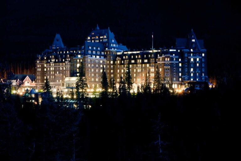
From the trail, we saw the Banff Hoodoos (more impressive than the Canmore Hoodoos if you ask me) and even spotted the Fairmont Hotel in the distance. The information boards on the trail also explain how the hoodoos were formed – pretty cool if you ask us.
Note: To visit Banff National Park, you’re going to need to purchase a Parks Canada Pass. You can find more info towards the end of this post.
17. Johnston Canyon

- Distance: 2.4 kilometers (1.5 miles) or 5 kilometers (3.1 miles) return (depending on which falls you turn around at)
- Elevation gain: 50 meters or 100 meters (164 feet or 328 feet)
- Difficulty: Easy
- Time needed: 1-3 hours
- Type of Trail: Out and back
Johnston Canyon is easily one of the best hikes in Banff National Park, and it is located only about a 40-minute drive from Canmore town. This epic hike takes visitors through a gorgeous canyon displaying unique rock formations, waterfalls, and bright blue water! You can read our guide to exploring Johnston Canyon here before you take off.
You have two options when it comes to hiking Johnston Canyon. There’s the choice of hiking just to the Lower Falls and then turning around, or continuing to the Upper Falls. The hike to the Upper Falls adds an extra 2.5 kilometers (1.5 miles) to your hike.
One of the best things about Johnston Canyon is that it is accessible all year round. In the summer, we were greeted by rushing water and beautiful waterfalls!
In the winter, expect a frozen winter wonderland. I’d recommend doing this guided ice walk here too, which includes round-trip transportation from Banff as well as all needed equipment (ice cleats and hiking poles). Once we finished up, we were presented with a snack and hot chocolate to help us warm up too. For $107 CAD, I also found it well-priced for what we got!
Check out the hundreds of 5-star reviews and book this guided ice walk in advance here!
Note: There will be some closures to vehicle traffic on sections of the Bow Valley Parkway this year (2024). From March 1-June 30 and then again from Sept 1-Sept 30 vehicles will NOT be able to drive the 17 km/11 mi stretch of road from the TransCanada-Highway junction to Johnston Canyon, it will be restricted to cyclists’ use only. This is the eastern part of the road that is affected if you’re traveling to Johnston Canyon from Banff. You will still be able to access Johnston Canyon and the Bow Valley Parkway via the intersection near Castle Mountain Chalets.
Related Read: Looking for even more hikes? Check out our list of Banff’s best hikes – there certainly isn’t a shortage!
18. Lake Agnes Tea House


- Distance: 3.6 kilometers (2.2 miles) one way
- Elevation gain: 400 meters (1,312 feet)
- Difficulty: Easy to moderate
- Time needed: 4 to 5 hours
Lake Agnes is absolutely stunning and the hike to get there is definitely worth the extra effort. Sure, this trail isn’t super flat, but it’s not technical and is well-maintained. Anybody with a moderate fitness level can complete the Lake Agnes Tea House Trail, even if they have no hiking experience.
In fact, the last time we hiked to Lake Agnes, we saw lots of families with children on the trail!
The Lake Agnes Tea House Trail begins with a steady incline through the forest. Eventually, we reached The Beehive which makes for a nice little stop. Shortly after, we came to a waterfall and then Lake Agnes and the tea house.
The tea house actually serves tea, coffee, snacks, and other goods you’d expect at a café. We grabbed a table and enjoyed the view with a cup of tea (brewed with glacier lake water, of course!).
The Lake Agnes Trail is known for being very busy. If you don’t want a crowded trail or wait in a huge line at the tea house, I suggest leaving early in the morning. This way, it’ll be easy to get a parking space where the trail starts from Lake Louise Lakefront.
This trail has so many cool spots along the way and things to look out for, so if you want to enjoy it to the fullest, I recommend having a little look at our complete guide to the Lake Agnes hike!
Note: From May until mid-October, you’ll be required to pay $36.75 CAD per vehicle per day to park at Lake Louise Lakefront (2025 updated price). The paid parking is in effect from 3 am until 7 pm daily.
19. Ptarmigan Cirque

- Distance: 4.2 kilometers (2.6 miles) return
- Elevation gain: Approximately 220 meters (722 feet)
- Difficulty: Easy to moderate
- Time needed: 1.5-2.5 hours
- Type of Trail: Loop
I haven’t had a chance to personally hike Ptarmigan Cirque yet, but I’ve heard great things! Pete from Road Trip Alberta has hiked the trail a few times though, and so he contributed the information below for us.
“From Canmore, you can reach the Ptarmigan Cirque parking lot and trailhead in about an hour’s drive. The drive itself is very scenic and makes for a fun little day trip!
My wife and I first hiked the Ptarmigan Cirque in Kananaskis this last summer and quickly recommended it to many friends. While it’s a relatively short trek – only 4.2 km (2.6 miles)- it begins at a high elevation (2,300 m/7,546 ft) and starts off with a moderately steep incline.
Once we cleared the treeline and caught our breath, we were wowed by the variety of mountain views and were instantly glad we made the effort.
After the initial climb, the path flattened out, and we quickly found ourselves in an alpine meadow surrounded by a wall of mountains. The path leads through rocky terrain and up to a waterfall before looping back to the other side and returning to the tree line.
The reason we (and many others) love the Ptarmigan Cirque is because of the variety of views it provides in such a short distance, and also because it’s a hike that can be enjoyed during all seasons. In spring, the full bloom of mountain flowers offers a beautiful, colorful palette.
And in fall, the yellow larches will be on a stunning display. Winter typically comes early in the region due to the high elevation, so be prepared with snow gear and warm clothes.”
The hike isn’t accessible from December through May, as the road through the Highwood Pass is closed. If you do plan on hiking the Ptarmigan Cirque, plan to do it on a weekday to avoid the large crowds, and it’s always recommended to arrive early as the parking lot fills up fast.
20. Moraine Lake Rockpile

- Distance: 0.8 kilometers (0.5 miles) return
- Elevation gain: Approximately 40 meters (131 feet)
- Difficulty: Easy
- Time needed: 30 minutes
- Type of Trail: Loop
Just over an hour’s journey from Canmore is the famous Moraine Lake. This lake is nothing short of stunning and one place you should absolutely visit when you’re in this part of the Canadian Rockies.
My personal favorite viewpoint at Moraine Lake is the one at the Rockpile. It is a very short trail that takes you through a series of stairs to the top of, you guessed it, a rock pile! From here, you’ll get the most epic view of Moraine Lake and Ten Peaks as her backdrop. It’s absolutely stunning and a must-do for anyone visiting the Lake Louise area.
It’s also easy to find the start of this mini-hike. Simply take the trail next to the bathrooms in the parking lot. Follow this trail and cross a small wooden bridge. Once you cross the bridge, keep walking up the trail and keep right (left goes to Consolation Lakes) and this trail leads up to the Rockpile.
Although this is a very easy hike, the challenge is getting here since the access road is closed to personal vehicles, so you’ll need to look into parking alternatives at Moraine Lake. Our top tip is to try booking a shuttle to Moraine Lake in advance!
Note: Moraine Lake is only accessible from the end of May until mid-September, depending on the weather. It closes during the colder months due to avalanche risk. For all the info, read our complete guide about how to get to Moraine Lake!
Want to visit Moraine Lake for sunrise?
Since the road is closed to personal vehicles, there are three options to visit Moraine Lake at sunrise: this organized tour, booking this privately-operated shuttle, or taking the Parks Canada Alpine Start shuttle.
- The tour begins at 4 am in Banff and includes not only a visit to Moraine Lake with hot chocolate and coffee to enjoy, but also an early morning visit to Lake Louise. That means you can visit two of the busiest lakes in Canada without the crowds or the stress of parking/shuttles. You can book the tour here with free cancellation up to 24 hours before.
- The new Moraine Lake sunrise shuttle includes transport only from Lake Louise Village at a cost of $99 CAD. They offer a few pick-up times with the first shuttle leaving at 4 am and the second at 5 am. You must book your spot online in advance here to avoid missing out.
- The Parks Canada Alpine Start shuttle leaves at 4 am and 5 am for $8 CAD. While it’s the cheapest option, it’s also the hardest to book. If you don’t grab tickets during the initial release of tickets in April, you’ll need to try to get tickets online at 8 am MDT two days before your trip.
21. Larch Valley Trail

- Distance: 8.6 kilometers (5.3 miles) return
- Elevation gain: 535 meters (1,814 feet)
- Difficulty: Easy to moderate
- Time needed: 5 – 6 hours
- Type of Trail: Out and back
The Larch Valley Trail also starts from Moraine Lake and is well worth the drive from Canmore! It is much longer than the Rockpile hike but also worth the extra effort. If you take your time in the beginning when it is steepest, you’ll find the Larch Valley Trail to be fairly easy as well!
If you’re lucky enough to be visiting Banff National Park in autumn, then the Larch Valley is a must-do. During this time of year, the leaves all change color, making it that much more beautiful.
The first part of the Larch Valley Trail is a bunch of switchbacks as you climb through the forest. Although tiring, the trail is well-maintained and not technical by any means. Once you make it to the valley, the track flattens out mostly until Minnestimma Lakes. From here, you can continue on and climb up to Sentinel Pass, but that is much more difficult and technical.
If you don’t want to deal with the hassle of arranging transport to Moraine Lake, then a pre-planned experience like this Banff National Park guided hike might be what you’re looking for! We love that you can choose between four very unique trails, including the Larch Valley Trail and the Consolations Lake Trail (more on this below).
With a gourmet picnic lunch included, this tour is pretty great value at $150 CAD per person, especially when you factor in the fact that return transport to Banff is included!
Check out available dates and book your spot on this guided tour here.
The Larch Valley is one of my absolute favorite hikes in Canada, and definitely one of the best hikes near Canmore. Don’t forget to check out our complete guide to the Larch Valley Trail, and you’ll know exactly what I mean!
22. Consolation Lakes

- Distance: 5.8 kilometers (3.6 miles) return
- Elevation gain: 65 meters (213 feet)
- Difficulty: Easy
- Time needed: 2-3 hours
- Type of trail: Out and back
Consolation Lakes Trail is probably the least popular trail that starts from Moraine Lake, which is surprising to me because it’s beautiful!
This relatively flat trail takes you from the Rockpile through the forest to two beautiful lakes around Banff. Because the trail is not very popular, it is much less crowded than the other trails in the area, making for a peaceful hike.
Although the trail is easy, at the end you will have to scramble over some rocks to actually make it to the lake’s edge. This part is a little more challenging but can be skipped as long as you’re satisfied not going all the way to the second lake.
23. Stewart Canyon

- Distance: 3 kilometers (1.9 miles) return
- Elevation gain: Very minimal
- Difficulty: Easy
- Time needed: 1-2 hours
- Type of trail: Out and back
This is honestly one of my favorite easy hikes in the Canmore and Banff area.
First of all, Stewart Canyon Trail starts at the stunning Lake Minnewanka. If you’ve never been to Lake Minnewanka before, then take my pro tip – go now! In the summer, you can go on a cruise on Lake Minnewanka and in the winter you can ice skate.
From Canmore, it’ll take you about 30 minutes to drive to Lake Minnewanka.
The hike to Stewart Canyon starts right at the parking lot at Lake Minnewanka and follows the lake’s edge until you reach a beautiful wooden bridge. The views from the bridge were just stunning as we stared down into Stewart Canyon.
Technically, the bridge is the point where you should turn around and walk back – this makes the trail 3 kilometers long (1.9 miles) in total. However, we wanted to continue going! The trail continues across the bridge and alongside the canyon. It was very peaceful, but if I’m being honest, the best views are before the bridge anyways.
This is a super easy trail with incredible views. Keep an eye out for wildlife too, I’ve seen countless deer on this trail and also foxes!
24. Lake Louise Lakefront Trail

- Distance: 4 kilometers (2.5 miles) return
- Difficulty: Easy
- Elevation gain: Minimal
- Time needed: 1-2 hours
- Type of trail: Out and back
Lake Louise is such a beautiful place to visit, so much so that we’ve dedicated tons of different blogs to this amazing location! The Lake Louise Lakefront trail, which stretches to the far end of the lake, is easily an unmissable activity to do while you’re here. From here, we got to look back and enjoy a view of Lake Louise that many don’t get to see!
The Lakefront Trail is super easy and flat! From the foreshore, it’s a 4-kilometer (2.5-mile) out-and-back hike and takes around an hour to complete. As I said, it’s flat and super easy!
Hot Tip: If you’re visiting Lake Louise in winter, you can actually just walk across the frozen lake to this viewpoint, cutting a little distance off the hike. Just be sure to check the ice conditions before you go!
25. Blackshale Suspension Bridge

- Distance: About 4 kilometers (2.5 miles) return
- Difficulty: Easy
- Elevation gain: Minimal
- Time needed: 1-2 hours
- Type of trail: Out and back
The Blackshale Suspension Bridge is a unique hike near Canmore for the simple fact that it is the only one with such an impressive suspension bridge to explore at the end! Kids love this bridge, and anybody will enjoy the views from the easy trail.
There is a bit of confusion surrounding this hike, as many complete it as part of the long Black Prince Loop. This is much longer and not the easiest way to get to the bridge. Instead, I suggest parking at the Black Prince Trail day-use parking, then walking back up the road towards the highway, crossing the highway, and getting on the trail labeled as “High Rockies.”
From here, we followed the trail but kept right when we got to the fork. There are some signs, but it is not totally obvious.
Alberta Parks has marked this trail as 1.4 km (2.5 mi) one way, but it is definitely longer, at least 2 km (1.24 mi) or even a little longer. With that said, the trail is relatively flat and easy enough. When we did it, plenty of families with young children were also on the trail.
Eventually, we reached the huge suspension bridge. This bridge is really impressive and well worth the hike. From here, I recommend walking back the way you came. There is an alternative route, but most people get lost and end up walking along the highway.
Other Things to do While You’re in Canmore

If you’re still putting together your Canmore itinerary, here are some of my personal favorite activities across all seasons that I would recommend to anyone!
- Explore the Canmore Caves – one of the best and most popular adventure tours on the outskirts of Canmore is this Canmore Caving adventure tour. You’ll rappel down into the Rat’s Nest Cave system and explore underground through narrow spaces before reaching a clear pool of water with impressive stalactites and stalagmites. This tour lasts 6 hours, costs $199 CAD, and includes all climbing gear and your own guide so you don’t get lost.
- Go ice skating on a frozen lake – if visiting Canmore in the winter one of the most epic and non-touristy experiences to have is to go skating on one of the area’s frozen lakes (usually frozen solid by mid-December). A few of my favorites are Gap Lake, Lake Louise, and Vermilion Lakes. If you don’t have your own skates you can easily rent a pair from Gear Up in town.
- Whitewater Rafting – an iconic Canadian activity that is sure to provide lots of scenic views, thrills, and laughs! After a safety briefing, this whitewater rafting tour will have you splashing through rapids for around 2 hours. It costs $140 CAD and is available in the summer from mid-May until mid-September.
- Wildlife Safari – Canmore is home to an abundance of wildlife, including black bears, grizzlies, moose, bighorn sheep, foxes, cougars, elk, coyotes, lynx, mountain goats, wolves, and more. Spotting wildlife on your own is often a coinflip so I recommend going on a wildlife tour with an expert who knows where and what to look for along with how to do so in a safe manner. This private half-day wildlife safari tour is a fantastic option that spends 2 hours on a drive through the Rocky Mountains and a 1.5-hour nature walk to track wildlife. It is pricey at $275 per person, but it’s worth it if you’ve been dying to see the native animals!
Where to Stay in Canmore


The truth is that there are so many hotels in Canmore that it can be hard to know which one to choose for your stay. Well luckily for you, Dan and I have stayed in a lot of different hotels in Canmore and have been able to narrow it down to our absolute favorites!
Here are the best places to stay in Canmore including our personal top choice, a budget option, and one for those looking for absolute luxury!
Coast Canmore Hotel & Conference Centre – Our Top Choice

Coast Canmore Hotel & Conference Centre is our absolute favorite place to stay in Canmore. It is affordable without sacrificing any of the comforts you’ll need for a relaxing and enjoyable stay – suitable for almost all travelers and budgets. They have an onsite pool, hot tub, and fitness center along with a delicious bar and restaurant (Table Food + Drink.)
Coast Canmore Hotel is located right in the heart of downtown Canmore walking distance from 8 Street (Main Street in Canmore), and just across the road from the Canmore shops where you have a selection of restaurants, cafes, and takeaway places.
Oh, and did I mention the views from the hotel windows are breathtaking!
On top of all of that, Coast Canmore Hotel offers a variety of different rooms to choose from, including some that are even pet-friendly (super handy when we are traveling with Rex!) The average cost per night ranges between $200-$400 CAD.
You can book this hotel easily on Booking.com. Be sure to book as far in advance as possible because these guys are usually fully booked!
The Malcolm Hotel – $$$
If money isn’t an issue, then The Malcolm Hotel may be the luxurious option you’re looking for. It’s an easy walk to the main part of town or there are shops and restaurants on the same street, although you may never want to leave the property! There’s a rooftop swimming pool and hot tub that are especially amazing at sunset. I also like the games room with giant scrabble and a pool table and the views from the rooms are picture-perfect.
However, rooms here don’t come cheap and are often up to twice the price of most hotels in Canmore. But if luxury is calling your name, check availability and book a room at The Malcolm here.
Canmore Downtown Hostel – $
If you’re a budget backpacker and looking for a hostel, then Canmore Downtown Hostel is your best choice! These guys offer clean and comfortable facilities, dorm beds as well as private rooms, and a social atmosphere perfect for meeting other backpackers, yet reviewers mention it is quiet at nighttime.
The shared lounge room even has incredible mountain views! A dorm bed in a co-ed room averages starts from around $55 CAD. You can book Canmore Downtown Hostel on Booking.com or Hostelworld.com.
If you want more options, you can look through all of the hotels in Canmore here!
Parks Canada Pass Quick Info
If you plan on spending time in Canada’s national parks (including Banff, Jasper, Yoho, Mount Revelstoke, Glacier, Kootenay, and more) then you’re going to have to pay for a Parks Pass.
Single Daily Admission:
This type of pass is valid for one person for one day. It is ONLY the best value if you are traveling alone and only plan to visit a national park for a couple of days.
- Adult (ages 18-64) is $11 CAD
- Senior (65+) is $9.50 CAD
- Youth/Child (17 or younger) is FREE
Group Daily Admission:
If you’re traveling in a group or with family, you can buy a single-day admission for your entire vehicle (up to 7 people in one vehicle.)
- $22.00 CAD gets your entire vehicle entry for one full day
Parks Canada Discovery Pass
The “Discovery Pass” is what Parks Canada calls their year-long (365 days from the purchase date), multi-park entry pass. This pass will give 365 days of access to all participating national parks in Canada. This includes the most popular parks like Banff, Jasper, Yoho, Kootenay, Glacier, Mount Revelstoke, and so much more.
- Adult (age 18-64) – $75.25 CAD
- Senior (65+) – $64.50 CAD
- Group/Family (up to 7 people in one vehicle) – $151.25 CAD
Hot Tip: Although more expensive up front, if you plan on spending more than 7 days in different parks in Canada within a 12-month period, then the Discovery Pass is actually the better deal!
Parks Canada Passes can be bought online here or at one of the Visitor Centers or booths at the entrance to many national parks.
Renting a Car in Alberta

If you’re arriving in Alberta via plane then I can’t recommend getting a rental car enough! Canada is a large country and traveling between cities and even just getting out to some of the best places to visit in Alberta requires transport. Although you can use public transport, on some occasions, it means your trip will not only require more time but more planning.
Renting a car will definitely make exploring all of the fun things to see and do in Alberta easier.
Car rental in Canada isn’t super cheap, but it isn’t overly expensive either, especially if you get a budget car. The cheapest car with pickup and drop-off in different locations is around $100 CAD per day. The price does vary though depending on the time of year and the type of car that you rent. For car rentals, I use the website DiscoverCars.com. It’s a search engine with lots of deals with good customer service. In fact, I’ve used them all over the world including in Chile, New Zealand, and Australia. Read our honest review of Discover Cars here for more details!
Check availability and prices on Discover Cars here!
Another popular option is to rent a campervan or motorhome (only for the brave in winter). Using Motorhome Republic you can search hundreds of deals across multiple companies to pick a great vehicle and the cheapest price. Having a motorhome is a stunning way to see Canada, and you can often camp for free or very cheap in the most beautiful places imaginable! Check out my review of Motorhome Republic here for tips before you book.
And if you’re planning to camp but don’t want to splurge on a huge RV, we highly recommend Smile Campervans. Based in Calgary, this local company provides compact campervans fully equipped with everything you need for a comfortable and affordable road trip adventure!
In fact, Smile Campervans has actually given us a special discount code for our readers! Use the code DESTINATIONLESSTRAVEL at checkout to get 5% off your campervan rental! Click here to browse availability, prices, and book with our discount code!
AIRALO e-SIM Up To 15% Off With Code “DTRAVEL15”
What’s an eSIM?
An eSIM is a digital version of a SIM card. Instead of buying a little plastic chip and swapping it into your phone, you just download it. It connects your phone to a local network in whatever country you’re visiting — no stores, no waiting, and no fiddling with tiny cards.
In simple terms, it’s the easiest way to get data and stay connected while traveling.
We’ve tested a bunch of eSIMs over the years, and after a few frustrating experiences, we’ve found our favorite — Airalo. It’s fast, reliable, and incredibly easy to use. You can set it up in minutes (even my mom managed it solo on her first try!), and the prices are some of the best out there.
💡 Bonus: We’ve got an exclusive 15% discount for our readers. Use the codes:
Thanks for reading!

And there you have, 25 easy hikes in and near Canmore, Alberta that practically anybody can accomplish! Of course, some of these hikes are more challenging than others, but I wrote this blog in hopes I’ve recommended a hike for everyone.
If you liked this blog, be sure to read the rest of our Canada blogs are a couple of related blogs below:
ULTIMATE Guide to Christmas in Banff + Seasonal Events


What a great article for my upcoming trip to Canmore! Is it safe to do these hikes alone?
Hey Kristyn,
Yes, these hikes are safe to do alone and will likely be busy. Please carry bear spray and make lots of noise.
Thanks
Daniel
Precise and informative! Really enjoyed your piece and will use it for my hikes in and around Canmore. My recent visit to Quarry Lake was inspired by your post and I posted a brief report on my photo blog. Keep it up!
Hey Malik,
That’s so great to hear. Enjoy!
Thanks
Bailey
Thanks so much for the tips! The instructions were super clear and the map links helpful, you made it so easy to find great the right hikes for me!!